GPS

GPS

GPS Device Drivers

In 1960, the US Navy first successfully proved and soon afterwards began use of its Transit satellite based navigation system to aid in ship navigation. From 1960 - 1982, as the benefits of a satellite based navigation system were proven over time, the US military consistently improved and refined its satellite navigation technology and satellite system. In 1973, the US military began to plan for a comprehensive worldwide navigational system which eventually became known as the GPS (global positioning satellite) system. In 1983, in the wake of the tragedy of the downing of the Korean Airlines Flight 007, an aircraft which was shot down while in Soviet airspace due to a navigational error, president Reagan announced that the navigation capabilities of the existing military-GPS system were to be made available for dual civilian use, however, civilians were to initially only be given access to the slightly degraded "Selective Availability" positioning signal.
This new availability of the US military GPS system for civilian use required a certain technical collaboration with the private sector for some time, before it could become a commercial reality. In 1989, Magellan Navigation Inc. unveiled its Magellan NAV 1000—the world’s first commercial handheld GPS receiver. These units initially sold for ca. $2,900 each. In 2000, the Clinton administration ordered the removal of military use signal restrictions, thus providing full commercial access to the use of the US GPS satellite system.

As GPS navigation systems became more and more widespread and popular, the pricing of such systems began to fall, and their widespread availability steadily increased. Also, several additional manufacturers of these systems, such as Garmin (1991), Benefon (1999), and TomTom (2002) entered the market. Benefon's 1999 entry into the market also presented users with the world's first phone based GPS navigation system. Later, as the smart phone industry developed, a GPS chip eventually became standard equipment for most smart phone manufacturers. To date, ever more popular GPS navigation systems and devices continue to proliferate with newly developed software and hardware applications.

While the American GPS was the first satellite navigation system to be deployed on a fully global scale, and to be made available for commercial use, this is not the only system of its type. Due to military and other concerns, similar global or regional systems have been, or will soon be deployed by Russia, the European Union, China, India, and Japan.

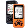
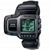
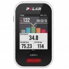
Dedicated devices have various degrees of mobility. Hand-held, outdoor, or sport receivers have replaceable batteries that can run them for several hours, making them suitable for hiking, bicycle touring and other activities far from an electric power source. Their screens are small, and some do not show color, in part to save power. Cases are rugged and some are water resistant.

Other receivers, often called mobile are intended primarily for use in a car, but have a small rechargeable internal battery that can power them for an hour or two away from the car. Special purpose devices for use in a car may be permanently installed and depend entirely on the automotive electrical system.

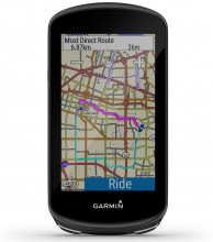
The pre-installed embedded software of early receivers did not display maps; 21st century ones commonly show interactive street maps (of certain regions) that may also show points of interest, route information and step-by-step routing directions, often in spoken form with a feature called "text to speech".

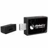
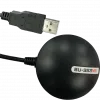
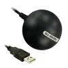
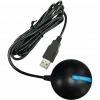
Some GPS devices need to be connected to a computer in order to work. This computer can be a home computer, laptop, PDA, digital camera, or smartphones. Depending on the type of computer and available connectors, connections can be made through a serial or USB cable, as well as Bluetooth, CompactFlash, SD, PCMCIA and the newer ExpressCard. Some PCMCIA/ExpressCard GPS units also include a wireless modem.

Devices usually do not come with pre-installed GPS navigation software, thus, once purchased, the user must install or write their own software. As the user can choose which software to use, it can be better matched to their personal taste. It is very common for a PC-based GPS receiver to come bundled with a navigation software suite. Also, GPS modules are significantly cheaper than complete stand-alone systems (around €50 to €100). The software may include maps only for a particular region, or the entire world, if software such as Google Maps, Networks in Motion's AtlasBook mobile navigation platform, etc., are used.

Some hobbyists have also made some GPS devices and open-sourced the plans. Examples include the Elektor GPS units. These are based around a SiRFstarIII chip and are comparable to their commercial counterparts